


6.7 km | 8.3 km-effort
![Trail On foot Sezimovo Ústí - [M] Sezimovo Ústí - Planá nad Lužnicí - Photo](https://media.geolcdn.com/t/1900/400/5b6d0c4e-5d11-4cd9-9c2c-b6cbb176e445.jpeg&format=pjpeg&maxdim=2)

Tous les sentiers balisés d’Europe GUIDE+


FREE GPS app for hiking
 SityTrail
IGN / Geographical institutes
SityTrail World
The world is yours!
Trail On foot of 5.2 km to be discovered at Southwest, Jihočeský kraj, Sezimovo Ústí. This trail is proposed by SityTrail - itinéraires balisés pédestres.
Trail created by cz:KČT.
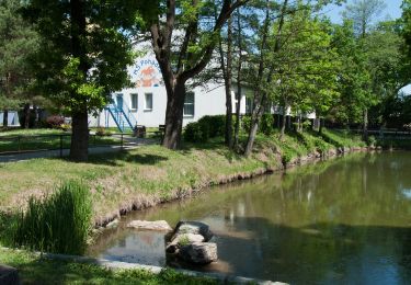
![Trail On foot Sezimovo Ústí - [M] Sezimovo Ústí - Planá nad Lužnicí - Photo 1](https://media.geolcdn.com/t/2048/auto/562101e5-69b7-4057-a06d-b38c257ff5cd.jpeg&format=jpg&maxdim=0 "Trail On foot Sezimovo Ústí - [M] Sezimovo Ústí - Planá nad Lužnicí - Photo 1")
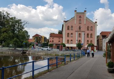
![Trail On foot Sezimovo Ústí - [M] Sezimovo Ústí - Planá nad Lužnicí - Photo 2](https://media.geolcdn.com/t/2048/auto/b22cc590-1b97-4abf-84cf-b4c6d6770591.jpeg&format=jpg&maxdim=0 "Trail On foot Sezimovo Ústí - [M] Sezimovo Ústí - Planá nad Lužnicí - Photo 2")
![Trail On foot Sezimovo Ústí - [M] Sezimovo Ústí - Planá nad Lužnicí - Photo 3](https://media.geolcdn.com/t/2048/auto/d1699deb-1489-431a-90b1-32405644bfb6.jpeg&format=jpg&maxdim=0 "Trail On foot Sezimovo Ústí - [M] Sezimovo Ústí - Planá nad Lužnicí - Photo 3")
![Trail On foot Sezimovo Ústí - [M] Sezimovo Ústí - Planá nad Lužnicí - Photo 4](https://media.geolcdn.com/t/2048/auto/8d9dafeb-28e6-4ab0-b01b-ea5eee557df4.jpeg&format=jpg&maxdim=0 "Trail On foot Sezimovo Ústí - [M] Sezimovo Ústí - Planá nad Lužnicí - Photo 4")
![Trail On foot Sezimovo Ústí - [M] Sezimovo Ústí - Planá nad Lužnicí - Photo 5](https://media.geolcdn.com/t/2048/auto/1ba647de-b290-4dc4-a8b4-66e0e213587b.jpeg&format=jpg&maxdim=0 "Trail On foot Sezimovo Ústí - [M] Sezimovo Ústí - Planá nad Lužnicí - Photo 5")
![Trail On foot Sezimovo Ústí - [M] Sezimovo Ústí - Planá nad Lužnicí - Photo 6](https://media.geolcdn.com/t/2048/auto/ab43af76-ff53-46ff-84aa-42f409b01045.jpeg&format=jpg&maxdim=0 "Trail On foot Sezimovo Ústí - [M] Sezimovo Ústí - Planá nad Lužnicí - Photo 6")
![Trail On foot Sezimovo Ústí - [M] Sezimovo Ústí - Planá nad Lužnicí - Photo 7](https://media.geolcdn.com/t/2048/auto/70da53c1-73dd-46a6-ab58-53a21e2702b1.jpeg&format=jpg&maxdim=0 "Trail On foot Sezimovo Ústí - [M] Sezimovo Ústí - Planá nad Lužnicí - Photo 7")
![Trail On foot Sezimovo Ústí - [M] Sezimovo Ústí - Planá nad Lužnicí - Photo 8](https://media.geolcdn.com/t/2048/auto/c55d006e-b7c5-4726-902c-c6813bd89c9f.jpeg&format=jpg&maxdim=0 "Trail On foot Sezimovo Ústí - [M] Sezimovo Ústí - Planá nad Lužnicí - Photo 8")
![Trail On foot Sezimovo Ústí - [M] Sezimovo Ústí - Planá nad Lužnicí - Photo 9](https://media.geolcdn.com/t/2048/auto/1fbade40-eed8-4fd5-8412-5597a94c3e14.jpeg&format=jpg&maxdim=0 "Trail On foot Sezimovo Ústí - [M] Sezimovo Ústí - Planá nad Lužnicí - Photo 9")
![Trail On foot Sezimovo Ústí - [M] Sezimovo Ústí - Planá nad Lužnicí - Photo 10](https://media.geolcdn.com/t/2048/auto/5b6d0c4e-5d11-4cd9-9c2c-b6cbb176e445.jpeg&format=jpg&maxdim=0 "Trail On foot Sezimovo Ústí - [M] Sezimovo Ústí - Planá nad Lužnicí - Photo 10")
On foot
![Trail On foot Sezimovo Ústí - [M] Choustník - Sezimovo Ústí - Photo](https://media.geolcdn.com/t/375/260/ext.jpg?maxdim=2&url=https%3A%2F%2Fstatic1.geolcdn.com%2Fsiteimages%2Fupload%2Ffiles%2F1545311037marcheuse_200dpi.jpg)
On foot
Other activity